This how-to guide shows how spatial workflows translate conservation goals into clear, actionable planning across U.S. landscapes. It focuses on applying geospatial tools to identify, analyze, and prioritize habitat and connecting features that boost biodiversity and pollination services.
Practical steps cover assembling spatial data, automating analysis with QGIS and PyQGIS, and running network tools such as Conefor to compute IIC, NC, and dIIC metrics. In one 80 km coastal network, small additions of habitat produced outsized gains in connectivity and overall habitat value.
The guide defines core terms — habitat, habitat patches, connectivity, corridors — and explains how graph-theory metrics reveal the role of patches in a fragmented matrix. It sets clear expectations for inputs, analysis steps, and how to interpret quality and value metrics for planning decisions.
Readers will learn how to build defensible, data-driven analyses that agencies, NGOs, and local teams can review and adopt. Later sections preview species selection, tools, metrics, and pathways to align implementation with policy and community resources.
Key Takeaways
- Follow a structured spatial workflow to turn conservation goals into site-level actions.
- Combine QGIS, PyQGIS automation, and network metrics to measure connectivity and value.
- Small, targeted habitat additions can greatly improve connectivity across landscapes.
- Graph-theory metrics clarify the role of patches and guide priority setting.
- Results produce defensible analyses that support planning and stakeholder review.
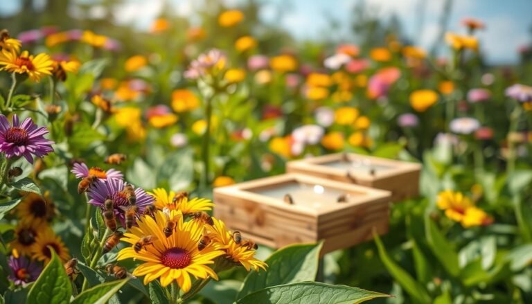
Why mapping pollinator corridors matters for U.S. conservation
Strategic reconnection of high-value habitat reduces isolation and boosts the return on conservation investments. Studies show that habitat loss and fragmentation drive declines in bees, butterflies, and moths, which directly affects crop pollination and wild biodiversity.
Biodiversity, pollination services, and ecosystem resilience
Pollinators link plants and people by supporting food production and wild species. Healthy networks of habitat sustain diverse communities and keep ecosystems resilient to shocks.
Higher-quality habitat can offset isolation. Where patches are small and isolated, species richness falls and populations become vulnerable.
From fragmented habitats to connected landscapes
Fragmentation reduces habitat availability and creates many small, low-value fragments across the land. Targeted reconnection raises overall connectivity and the ecological value of remaining areas.
- Decision-ready maps make the role of different habitats clear to planners and stakeholders.
- Prioritizing areas by availability and connectivity focuses scarce funds on actions that sustain populations.
- Well-designed corridors protect ecosystem function as land use changes, helping both rural and urban areas.
Know your pollinators: focal species and groups to plan for
Choosing focal species turns broad goals into concrete design rules. Pick representative groups — bees, butterflies, moths, and hummingbirds — to set foraging distances, nesting needs, and movement behaviors. This approach helps define patch sizes and placement across planning areas.
Bees, butterflies, moths, and hummingbirds: roles and ranges
Bees vary from small, ground‑nesting specialists to wide‑ranging bumble bees; nesting substrate and floral resources drive where habitat must be retained or added.
Butterflies like the Eastern Tiger Swallowtail breed in mixed forests and swamps and visit milkweeds and native orchids, guiding forest-linked stepping stones.
Moths such as the Hermit Sphinx move at night and pollinate rare orchids like Platanthera leucophaea, showing how night‑active insects need connected habitat corridors for plant reproduction.
Hummingbirds, notably Anna’s Hummingbird, now range from southeastern Alaska to northwestern Mexico and pollinate gooseberry, monkey‑flower, penstemon, and fuchsia — useful for western planning where gardens and native shrubs support range expansion.

- Rusty‑patched Bumble Bee: sharp decline in northeastern U.S.; pathogens from managed bees are a likely factor — see this habitat and disease risks study.
- Southeastern Blueberry Bee: nests in coastal sandy soils and buzz pollinates blueberries, illustrating how nesting and floral needs shape habitat decisions.
Plan for local populations by aligning chosen species with current distribution and range trends so corridors support actual pollination and conservation outcomes.
Data you’ll need before you open your GIS
Start by assembling reliable spatial and ecological layers so your analysis rests on clear, auditable inputs. Collect vector habitat layers, land cover, protected and proposed conservation areas, and urban boundaries as core base data.
Habitat patches and quality
Assign unique IDs and consistent geometry to each patch. Add attributes for size, vegetation type, and habitat quality, including overlap with designated wildlife or protected areas that imply higher management standards.
Species and ecology inputs
Compile foraging ranges (e.g., 250–1,000 m for many bees; 250–800 m for some moths), nesting resources (soil, stems, cavities), and bloom timing so floral resources match species activity windows.
Ancillary layers and data structure
Include land use classes, known barriers (roads, fences), green infrastructure, and community stewardship resources. Track sources and metadata for reproducibility.
- Prepare plant species lists and bloom calendars.
- Capture foraging distances to set connectivity thresholds.
- Compile quality indicators (size, protection status, management notes).
- Stage storage and analysis tools so data availability is immediate when analysis begins.
GIS setup and tools for corridor analysis
Start by locking a clear project schema so every run produces auditable outputs. Define layer names, a unique ID field for each patch, and fields for size and quality indicators.

Recommended software stack
Use QGIS (v2.18 or later) for mapping and data management. Add PyQGIS scripts to automate repetitive tasks. Run Conefor for edge-to-edge distances and node importance (IIC, NC, dIIC).
Organizing a reproducible workflow
Structure folders by raw data, processed layers, and results. Track versions with simple revision numbers or Git for text and scripts. Save logs for every analysis step to support stakeholder review.
- Prepare patch nodes from vector habitat layers and export distance matrices for Conefor.
- Build a QGIS model to select pollinator-supporting habitat patches and standardize outputs.
- Include quality attributes (protection status, floral resources) so analysis reflects conservation value, not just size.
Validation checklist: IDs present, CRS consistent, no geometry errors, attribute fields complete, and sample outputs verified before full analysis.
Connectivity metrics that guide decisions
Connectivity indices translate spatial patterns into actionable priorities for conservation teams. These metrics help convert mapped habitat into defensible recommendations for investments and management.
IIC and NC: interpreting habitat availability and components
Integral Index of Connectivity (IIC) quantifies overall habitat availability on a 0–1 scale by combining patch area, quality, and topological distances. A higher IIC signals more available habitat for focal species across the network.
NC counts connected components. Fewer components mean less fragmentation and better landscape flow for movement and gene exchange.
Patch importance with dIIC: prioritizing high‑value habitat patches
dIIC measures the percent drop in IIC if a patch is removed. Large dIIC values identify high‑value patches that maintain network value.
“Use dIIC to flag patches whose protection or restoration yields outsized gains in habitat availability and resilience.”
Choosing distance thresholds for bees, butterflies, and moths
Common thresholds bracket species groups: ~250 m for small solitary bees, 500 m for many butterflies, and 800–1,000 m for larger moths and wide‑ranging species. Apply multiple thresholds to capture uncertainty across groups.
- Higher IIC and lower NC indicate better-connected habitat for target species and inform site prioritization.
- Quality attributes (protection status, floral resources) shift patch rankings beyond size alone.
- Report IIC, NC, and dIIC with maps to justify conservation planning and funding choices.
- Recalculate metrics periodically as distribution and habitat change to keep recommendations current.
Mapping pollinator corridors using GIS: step‑by‑step workflow
Begin with a clear, repeatable workflow to turn habitat layers into actionable conservation maps. Extract candidate habitat patches from Phase 1 datasets, tag each feature with a unique ID, size, and a simple quality score. Clean geometry and remove slivers to avoid errors in distance calculations.
Selecting pollinator‑supporting habitat patches
Pick habitat types that provide nesting or floral resources for bees and butterflies. Add attributes for foraging range and protection status so the analysis reflects on‑the‑ground value.
Calculating edge‑to‑edge distances and building networks
Compute Euclidean edge‑to‑edge distances among patches at 250 m, 500 m, and 1,000 m thresholds. Export distance matrices to run network metrics in Conefor and check for anomalies before full runs.
Computing IIC/NC, ranking patches by dIIC, and visual styling
Run IIC and NC to quantify availability and fragmentation. Calculate dIIC to rank patches; highlight patches with dIIC >2% and note any reaching ~11% after proposed additions.
Designing stepping‑stones and linear connections at multiple thresholds
Test adding stepping‑stone sites at 250 m and 500 m to measure increases in IIC and reductions in NC. Iterate designs and re-run metrics until benefits meet conservation goals.
“Small, well-placed additions often yield outsized gains in connectivity and habitat availability.”
- Select and clean habitat patches with IDs and quality fields.
- Compute edge-to-edge distances for target species ranges.
- Run Conefor to get IIC, NC, and dIIC.
- Rank patches by dIIC and style maps for stakeholder review.
- Design and test stepping-stone and linear links; iterate and document results.
| Step | Thresholds | Key output |
|---|---|---|
| Distance matrix | 250 m, 500 m, 1,000 m | Edge-to-edge distances for networks |
| Network metrics | All thresholds | IIC, NC, dIIC per patch |
| Design test | 250 m & 500 m | IIC increase; NC decrease; dIIC up to ~11% |
Designing corridors across diverse U.S. landscapes
Design choices depend on land use, species range, and realistic management across ownerships. Agricultural fields, rangelands, and urban lots each shape what works on the ground.
Working agricultural matrices, rangelands, and urban areas
In farmed landscapes, small habitat patches and field margins fit alongside production. These additions support species that can cross short gaps.
Rangelands allow broader mosaics and are suited to landscape corridors that link distant habitats. Sparse development in these areas favors long-range movement.
In cities, greenways and pocket sites create stepping stones among parks and roofs. Urban planning must integrate floral resources and nesting spots.
Linear, stepping‑stone, and landscape corridors: when to use each
Linear routes (riparian buffers, rights‑of‑way) suit species needing continuous cover. Stepping‑stones work where short gaps are tolerated.
Landscape mosaics support multi‑species goals at larger scales. Small, strategic habitat additions often yield outsized gains in connectivity.
| Context | Recommended approach | Key consideration |
|---|---|---|
| Agricultural matrices | Field margins, stepping‑stones | Balance production and habitat; site floristics to local crops |
| Rangelands | Landscape mosaics | Scale and placement to match wide-ranging species |
| Urban areas | Linear greenways & pocket sites | Seasonal bloom, nesting, and public access |
Urban applications: pollinator gardens to city‑scale greenways
City projects that add diverse floral resources and nesting sites increase habitat availability for local bees. Small plantings add measurable habitat value when they follow simple design rules. Combined, these sites form functional links across urban areas.
Selecting native plants and ensuring season‑long bloom
Choose native plants adapted to local soils and climate. Mix early, mid, and late bloomers so nectar and pollen are available from spring through fall.
Use layered plantings—groundcovers, herbs, shrubs, and small trees—to expand floral availability and shelter.
Nesting habitat, water, and microhabitat features for pollinators
Provide bare soil patches, hollow stems, dead wood, and a few bee hotels to support diverse nesting needs. Add shallow, clean water near flower beds as an essential resource.
These features raise habitat quality and help sustain populations through hot, dry periods.
Leveraging parks, trails, rights‑of‑way, and green roofs for connectivity
- Integrate pocket parks, linear greenways, and green roofs into site design to link small habitats across the city.
- Adopt simple standards so many small sites add up to effective networks.
- Engage community volunteers for planting, maintenance, and monitoring to ensure long‑term success.
“Small, well‑placed urban actions deliver outsized gains in habitat and availability for pollinators.”
Validation, monitoring, and adaptive management
Field validation confirms whether mapped sites actually support the species and plant communities identified in models. Ground checks link model outputs to real-world condition and help target limited funds effectively.
Ground‑truthing methods include short timed surveys, floral transects, and brief nest checks to verify habitat quality. Visit prioritized patches in different seasons to capture bloom and nesting windows.
Ground‑truthing habitat quality and corridor use
Use standardized score sheets for vegetation, bloom timing, and structural nesting features. Record presence or absence of focal species and any signs of movement between sites.
Monitoring tools: camera traps, genetics, and community science
Tools range from motion cameras and malaise traps to genetic markers that show gene flow. Community science platforms add wide coverage of observations and distribution trends.
Iterating with updated land use, bloom data, and population trends
Update land‑use and seasonal bloom data regularly and re-run connectivity analysis to track IIC and NC changes. Integrate results into planning cycles and adapt management where availability falls short.
“Consistent protocols let managers compare results over time and confirm that investments improve populations.”
| Action | Method | Primary result |
|---|---|---|
| Ground‑truth | Timed surveys, transects | Verified habitat quality |
| Monitor | Camera traps, genetics, community reports | Species presence & distribution |
| Update | Land‑use & bloom layers | Recalculated connectivity & patch rankings |
| Adapt | Planning cycles, maintenance change | Improved availability and performance tracking |
From analysis to action: policy, funding, and partnerships in the United States
Turn analysis outputs into clear policy steps that preserve high-value habitat and guide local land use decisions. Use reports and maps to show how targeted actions raise habitat value and reduce fragmentation. Pack results into simple recommendations for officials and community partners.
Zoning, easements, and wildlife‑friendly infrastructure
Adopt zoning overlays, setbacks, and conservation easements to protect priority areas and patches. Introduce design standards for wildlife crossings and green infrastructure to keep movement routes functional.
Funding mechanisms and incentives for private landowners
Identify federal, state, and local grants, plus philanthropic funds and programs like the Land and Water Conservation Fund. Offer tax credits, cost-share assistance, and easement payments so landowners restore or maintain habitat.
Regional conservation planning and stakeholder collaboration
Align municipalities with clear memoranda of understanding to pool resources across jurisdictions. Build partnerships among agencies, NGOs, and community groups to steward patches, trails, and rights‑of‑way.
“Use data-rich reports to make the case for investments and sustain long-term planning commitments.”
| Action | Mechanism | Expected result |
|---|---|---|
| Zoning & overlays | Local code changes | Protected priority areas |
| Incentives | Tax credits, cost-share | Landowner participation |
| Regional plans | MOUs, pooled funds | Coordinated implementation |
Conclusion
Analyses that compare IIC and NC reveal practical gains from small, well-placed habitat additions. Evidence shows modest site additions can raise connectivity and availability across a mix of species, from Anna’s Hummingbird to the Rusty‑patched Bumble Bee and the Hermit Sphinx.
Apply a metrics-driven workflow to rank habitat patches, test designs, and align site design with species range and movement. Urban and rural actions complement one another to knit habitats into functional regional networks.
Keep monitoring and adaptive planning, build community partnerships, and pair policy tools with targeted plant palettes. For urban context and path-length findings, see this urban habitat study.
Assemble teams and start the workflow to accelerate planning—continued refinement of data and practice will improve outcomes for pollinators, insects, and broader biodiversity.
FAQ
What is the goal of mapping pollinator corridors for conservation efforts?
The goal is to identify and link high‑quality habitat patches to support movement, foraging, nesting, and reproduction of bees, butterflies, moths, and hummingbirds across landscapes. This guides conservation planning, habitat design, and restoration to boost biodiversity, stabilize populations, and maintain pollination services in agricultural, rangeland, and urban settings.
Why does connecting habitat patches matter for ecosystem resilience?
Connected habitats increase genetic exchange, reduce local extinctions, and allow species to track seasonal resources such as bloom timing. Improved connectivity helps pollinator populations persist under land‑use change and climate shifts by enabling movement between refuges, stepping‑stones, and larger reserves.
Which focal species or groups should I include when planning corridors in the United States?
Focus on a range of functional groups: ground‑nesting and cavity bees, bumble bees like the Rusty‑patched bumble bee where applicable, butterflies and moths with specific host‑plant needs, and nectar‑dependent birds such as Anna’s hummingbird in appropriate regions. Include generalist and specialist taxa to cover varied foraging ranges and nesting requirements.
What spatial and ecological data are essential before starting analysis?
Core inputs include land cover and habitat patch layers, protected areas, and urban green spaces; species data such as foraging ranges, nesting resource locations, and phenology (bloom timing); and ancillary layers like land use, barriers (roads, water), green infrastructure, and community resources for outreach and stewardship.
Which software and tools are recommended for corridor analysis?
Use an open, reproducible stack: QGIS for mapping, PyQGIS or R for scripting and automation, and Conefor or similar tools to compute connectivity metrics like IIC and NC. GIS toolboxes, version control, and documented data schemas help make workflows repeatable.
How do connectivity metrics like IIC, NC, and dIIC inform decisions?
IIC and NC quantify habitat availability and structural connectivity across the network. dIIC measures the contribution of individual patches to overall connectivity, letting planners prioritize high‑value patches for protection or enhancement. Use these metrics alongside ecological knowledge of species movement distances.
How should I choose distance thresholds for different pollinator groups?
Base thresholds on species’ typical foraging and dispersal ranges. Small solitary bees often move tens to a few hundred meters, bumble bees several hundred meters to a few kilometers, and many butterflies/moths vary widely. Use multiple thresholds to capture diverse movement behaviors and to design both local stepping‑stones and broader linear links.
What are the core steps in a reproducible corridor workflow?
Key steps: define focal species and thresholds; select and classify habitat patches by quality; calculate edge‑to‑edge distances and build connection networks; compute IIC/NC and dIIC scores; rank patches for action; and style maps for stakeholders. Document data sources and processing to ensure reproducibility.
How can corridors be designed across different U.S. landscapes like farms, rangelands, and cities?
Tailor strategies: in agricultural matrices, integrate field margins, hedgerows, and cover crops; in rangelands, protect native flowering plants and nesting sites; in urban areas, prioritize parks, green roofs, and rights‑of‑way. Choose linear corridors, stepping‑stone patches, or landscape mosaics based on land use and species needs.
What plant and habitat features are most important in urban applications?
Select native plants that provide staggered, season‑long bloom; supply nesting substrates (bare ground, stems, cavities), water sources, and sheltered microhabitats. Use parks, trails, community gardens, and green infrastructure to create interconnected habitat networks that support local pollinator populations.
How do I validate models and monitor corridor effectiveness?
Combine ground‑truthing of habitat quality with monitoring tools: standardized transect surveys, camera traps, genetic sampling, and community science platforms like iNaturalist. Update analyses with new land‑use data, bloom observations, and population trends to adapt management actions.
What policy tools and incentives support implementing connectivity plans?
Zoning and conservation easements, wildlife‑friendly infrastructure standards, and incentive programs for private landowners can secure habitat. Funding mechanisms include USDA conservation programs, state grants, and partnerships with NGOs. Engage stakeholders early to align planning with local priorities.
How can practitioners prioritize actions when resources are limited?
Use dIIC and habitat quality scores to identify high‑priority patches that yield the greatest connectivity gains. Target actions that create multiple benefits—native plantings that support forage, nesting, and seasonal resources—and leverage community programs to scale efforts across land ownerships.
What role do community science and local stakeholders play in corridor projects?
Community groups provide observations, help monitor bloom timing and pollinator presence, and implement neighborhood plantings. Partnering with landowners, municipal agencies, and extension services builds stewardship, improves data coverage, and increases chances of long‑term success.
What additional data layers improve corridor planning beyond land cover and species ranges?
Include bloom phenology, nesting substrate maps, pesticide application zones, microhabitat features, and socio‑economic layers showing ownership and community resources. These layers refine habitat quality assessments and help design feasible, effective interventions.